Anaearth – Process Quicker. Decide Smarter
High-Efficiency 2D & 3D Mapping Software for Fast, Accurate, and Intelligent Geospatial Reconstruction

Nearly two decades of experience in geospatial projects and aerial surveying enable us to understand the evolving challenges in mapping, surveying, and spatial data processing. Anavision software’s AnaEarth – Fast Stitching Software utilizes advanced photogrammetry technology, intelligent spatial algorithms, and AI-assisted processing techniques to deliver high-efficiency 2D & 3D reconstruction solutions for various industries. The platform integrates fast aerial image stitching, GIS analysis, annotation tools, and intelligent reconstruction workflows into a single professional solution.
AnaEarth is designed to simplify complex mapping processes while maintaining survey-grade accuracy and industry-leading reconstruction performance. By combining intelligent automation with a user-friendly workflow, AnaEarth helps organizations accelerate project delivery, improve spatial data quality, and optimize operational efficiency across plantation management, mining, construction, infrastructure, and environmental monitoring sectors.
Based on our benchmark testing, AnaEarth delivers significantly faster reconstruction performance compared to conventional photogrammetry software while maintaining high precision and reconstruction quality. Our objective is to help organizations produce accurate geospatial information more efficiently, reduce processing time, minimize operational costs, and support faster, data-driven decision-making through intelligent mapping technology.
Why Us
Simple Workflow
Fastest Processing Speed
High Accuracy
Professional GIS Integration
What We Offer
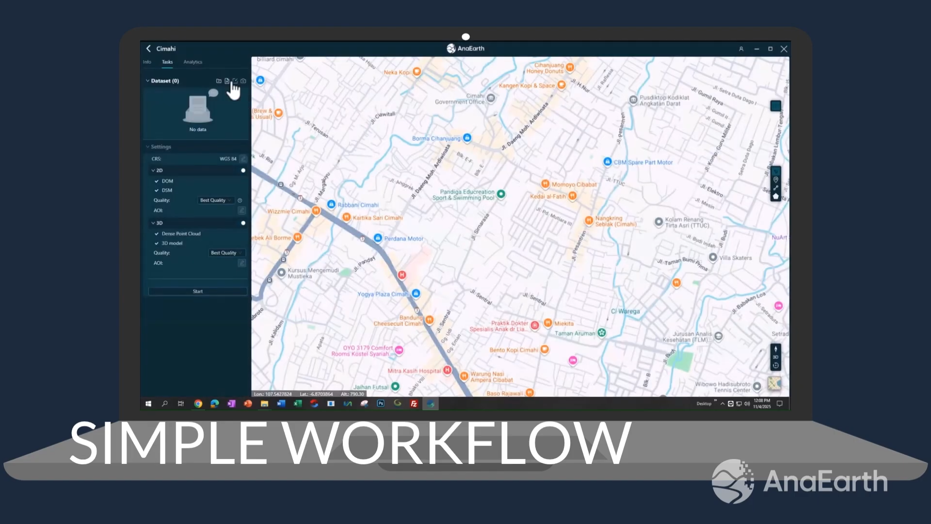
Simple Workflow
AnaEarth is designed with a user-friendly and intuitive workflow that simplifies the entire mapping process, enabling users to generate professional 2D and 3D outputs without requiring advanced photogrammetry expertise.
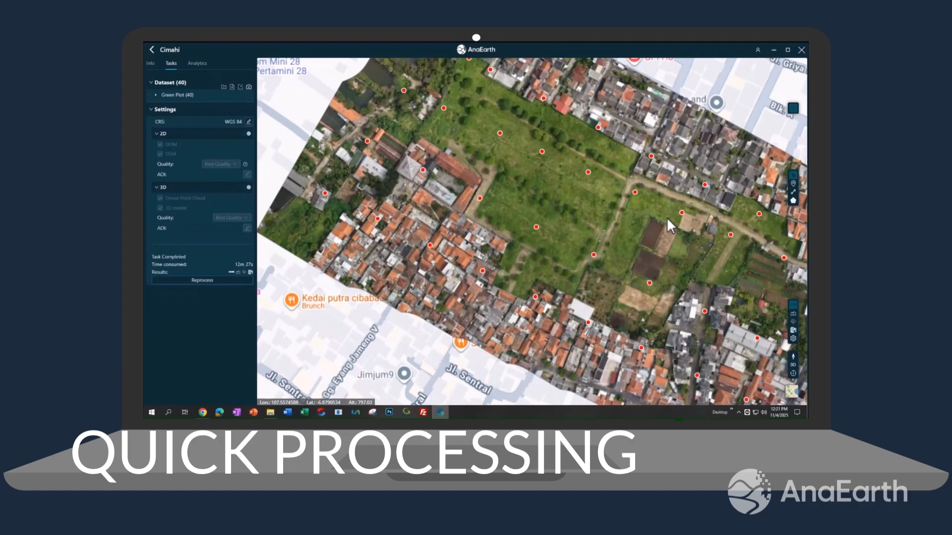
Quick Processing
Powered by high-performance reconstruction technology, AnaEarth delivers industry-leading processing speed to significantly reduce project turnaround time while maintaining high-quality mapping results.
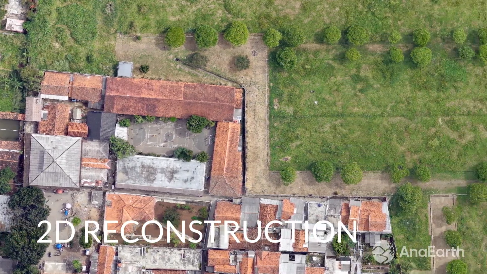
2D Reconstruction
AnaEarth produces high-accuracy orthomosaic and DOM outputs from aerial imagery, providing clear, detailed, and reliable 2D maps for surveying, inspection, and spatial analysis purposes.
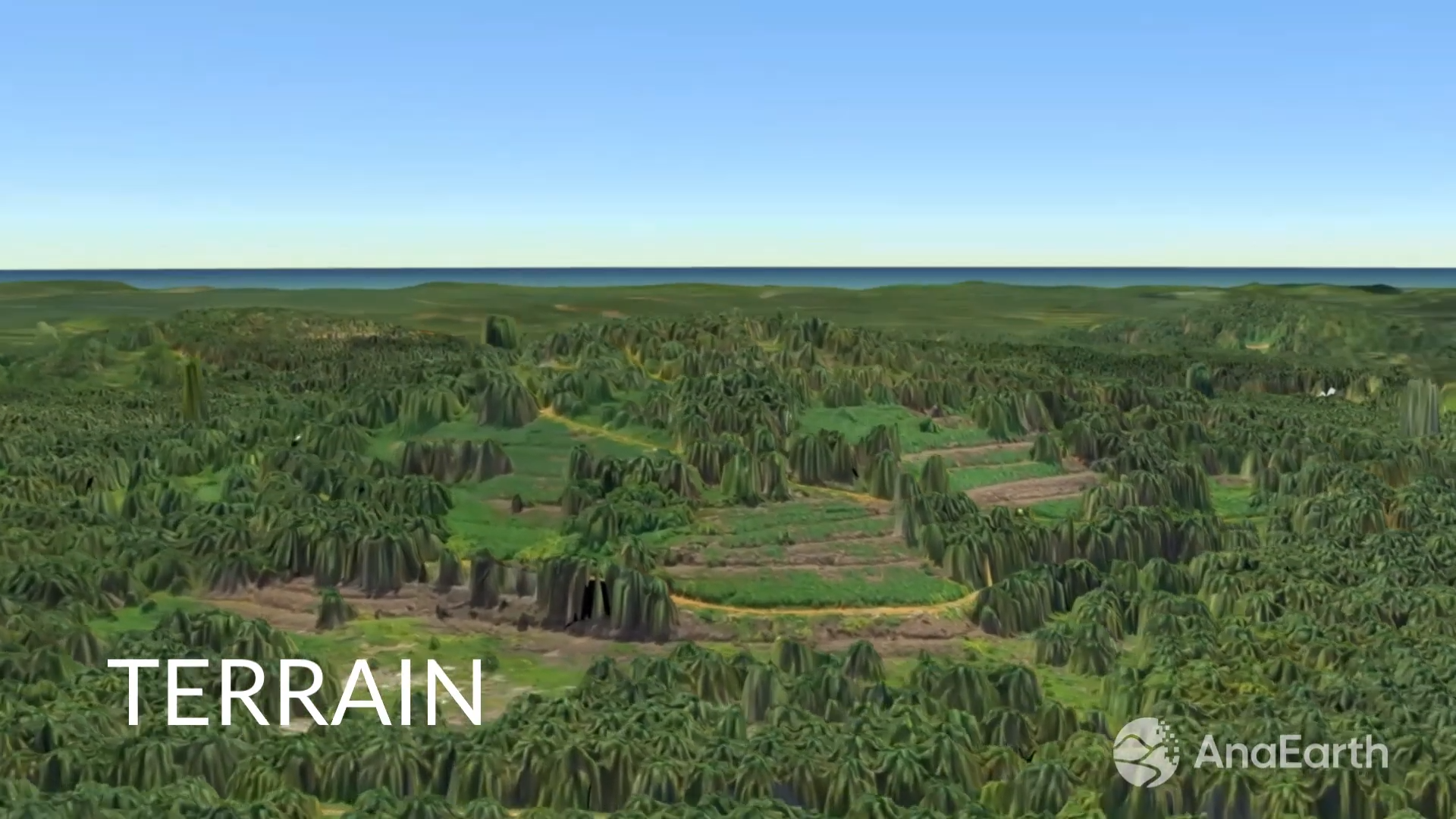
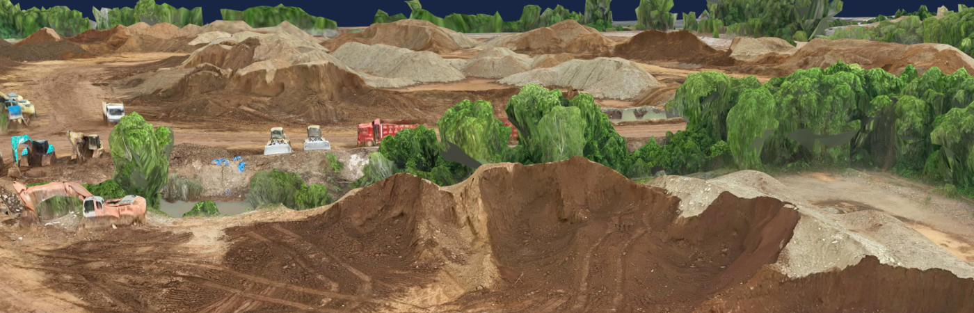
Terrain
The terrain reconstruction capability enables users to generate accurate DSM and terrain visualization models for contour analysis, elevation mapping, and land surface assessment.
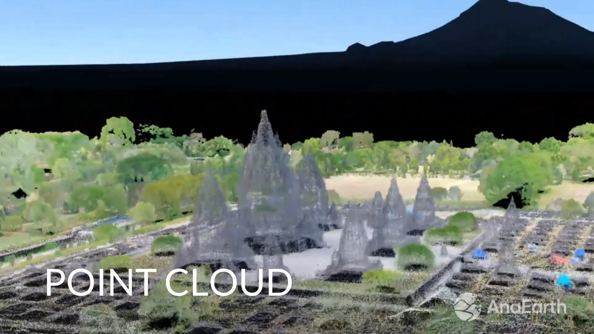
Point Cloud
AnaEarth generates dense and precise point cloud data that supports advanced spatial analysis, measurement, and detailed surface representation for various geospatial applications.
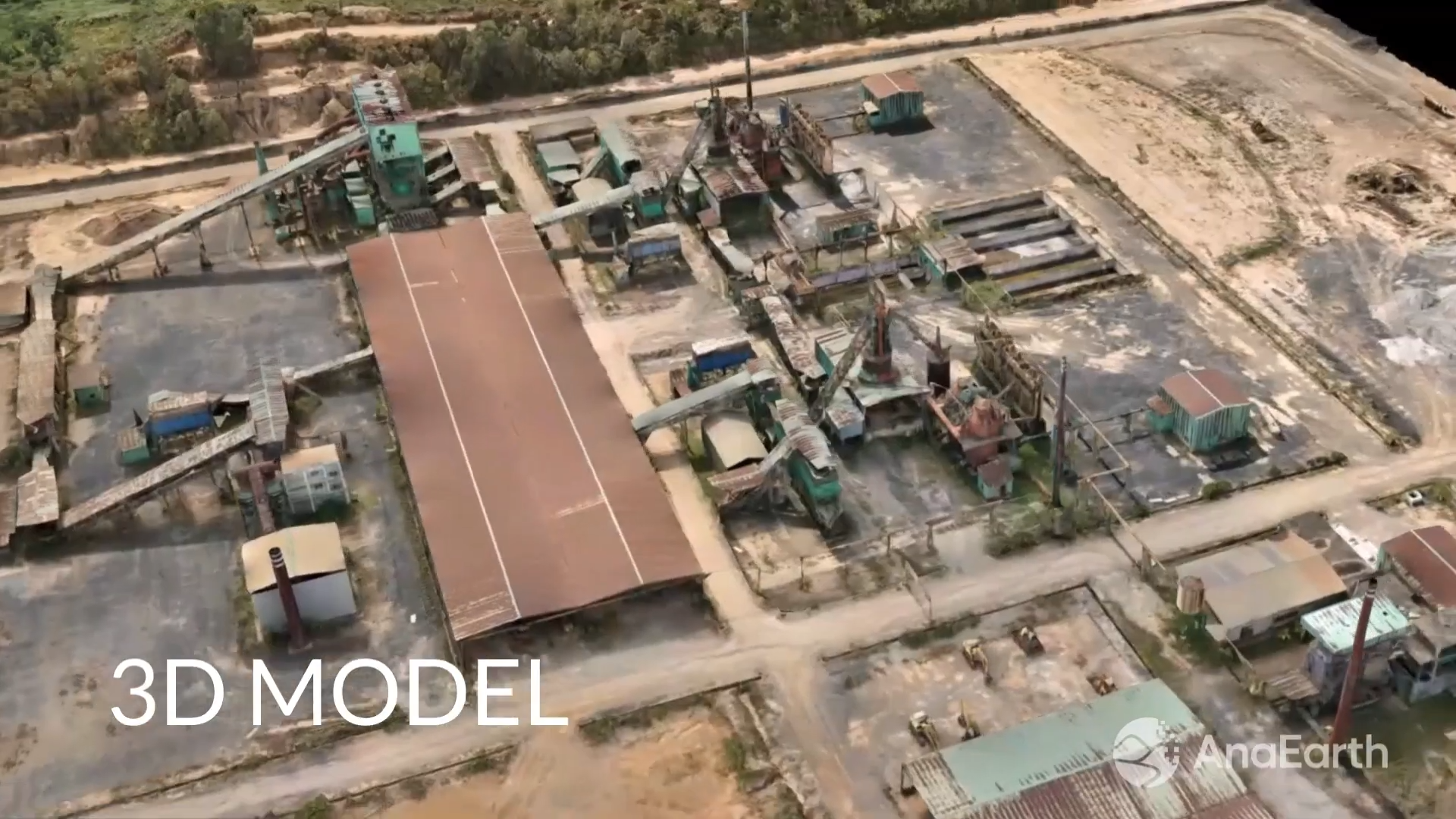
3D Model
AnaEarth creates realistic and high-quality 3D models from aerial imagery, helping users visualize environments more effectively for planning, inspection, monitoring, and presentation needs.
Support
Industry-Leading 2D & 3D Reconstruction Performance
Industry-Leading 2D & 3D Reconstruction Performance
| Dataset | Configuration | AnaEarth | Competitor | |||
| 361 Photos | 2D + 3D High Quality | 13m 49s | 22m 59s | |||
| 1840 Photos | 2D + 3D High Quality | 2h 46m | 3h 42m | |||
| 3420 Photos | 2D + 3D High Quality | 5h 03m | 8h 42m | |||
Recommended Application Industries
a) Plantation & Agriculture
b) Mining & Quarry
c) Infrastructure & Construction
d) Land Surveying
e) Environmental Monitoring
f) Forestry Management
g) Urban Planning
Suggested System Requirements Section
Recommendation Configuration
a) Operating System: Windows 10/11
b) Processor: Intel i7 / AMD Ryzen equivalent
c) RAM: 32 GB or above
d) GPU: NVIDIA GPU with dedicated VRAM
e) Storage: NVMe SSD recommended
AnaEarth Brochure
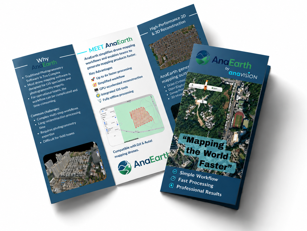
AnaEarth Brochure
Contact us today to explore how Anavision can help drive innovation and success for your company.
Get in Touch