Suitability analysis is one key technology used in Geographical Information System (GIS) to evaluate the suitability of a system or to locate the best site for different needs. It is a systematic and multi-factor analysis including diverse physical, cultural, and economic inputs. Maps often represent its result to highlight areas from high to low suitability. This approach enables decision makers to interpret the valuable information under methodologically rigorous conditions with relatively low cognitive processing levels demanded.
This analysis typically answers questions like “Where is the best place for…?”. For instance, a real estate developer plans to build a new residential building. The developer may consider distance to major roads, land use type, existing facilities, and population density to decide on the best location for that residential.
This technology is widely used by stakeholders, not only socioeconomic sectors, interest groups, and authorities. Most common GIS applications which apply suitability analysis include but are not limited to land use selection, retail site selection, urban planning, agriculture, environmental protection, disaster prevention, and even crime analysis.
Our GIS expert can provide solutions for this type of analysis in quick response by delivering customized GIS Models or Tools to meet clients’ needs. The customized Model or Tools enable clients to process the analysis repeatedly and efficiently, only swapping the inputs. By applying the customized Model, we can cut down the days’ manual processing time to hours.
The following paragraph gives an example of suitability analysis application in environmental protection field.
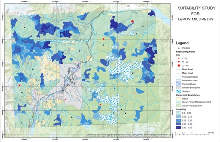
The topics of suitability assessment can be various as long as we come up with a set of rules to define “more feasible” or “less feasible”. The result generally comes down to an evaluation index that indicates the feasibility of concerned areas with “0” being not feasible at all and “1” being most feasible above all, just as you can see in the diagram above, darker shade of blue indicates greater value of evaluation index, hence more suitable habitat for Lepus Millipedis. This way, decision makers can have a strong scientific reference for how the land concerned shall be used.
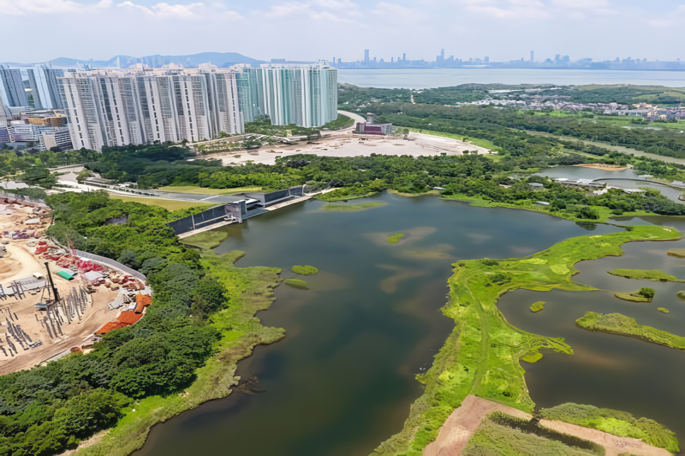
Solution to optimize land use in Hong Kong
Hong Kong is known for its overwhelming land price, given its limited space with relatively dense population. At this roaring speed of urban development, people have been trying to make the most out of given space and maximize the utilities we could have, hence it’s important that we make accurate assessment on the conditions of land and perform appropriately according to development plan.