Have you ever spotted odd gravestones along the trail while hiking? In Chinese culture, people believe that feng shui is an important indicator to help find the perfect afterlife home for the ancestors. Up in the hill, near the river, and with no blocking of sunlight, these are the main criteria to tick off when locating the grave to harness energy forces in the natural world. However, in order to find the perfect spot, trees are cut down by individuals. This has been causing deforestation in a lot of state-owned lands.
An A.I. Solution for Land Use Inspection
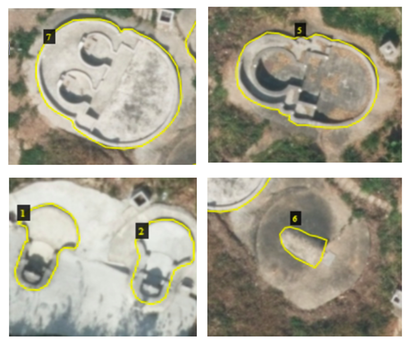
In this project, we use our state-of-the-art A.I. technology to search down the line and locate burial grounds accurately. Our A.I. solution can automatically pinpoint grave locations on the map and provide measurements with high accuracy. This is done by feeding aerial images taken in the old days, together with the images captured recently into our customized neutral network. Markings indicating individual areas of the cemetery plots on the map system is the yield from this deep learning based A.I. system.
Figure 1: Some examples of cemetery plot annotations in the aerial image data
The A.I. Burial Grounds Detection System serves the purpose of keeping a survey record of existing graves. Tracing back to aerial image data from the 60s, it can also detect changes in the designated areas-the number of gravestones specifically in this project. Such information is extremely helpful for facilitating reinforcement of land use policy in order to protect forests and historical places from being damaged. With the aid of our A.I. Burial Grounds Detection System, government officials and land owners can ensure all burial grounds are properly standing within the permitted sites and keep a consolidated log.
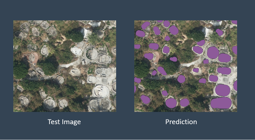
Figure 2: An example of the output from the A.I. grave detection system, viewed with a GIS software
One might argue that object detection in imagery is no innovation. Yet, solutions for such analysis with an eagle’s-eye view are harder to come by than one would think, let alone the niche subject in this project. At Anavision, we combine our expertise in GIS survey and computer vision to turn aerial images into valuable information with data analysis and visualization.