Recently, remote sensing technology has opened up the possibility of performing large scale building detection from aerial imagery.
Deep Learning Approach for Building Detection
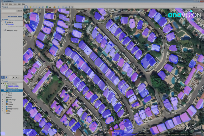
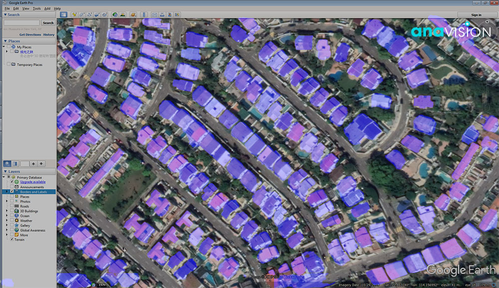
Anavision offers a deep learning model that uses these high-resolution aerial images as an input to analyze and identify existing buildings in the city, count them and measure the size of the building. One of the main objectives is to compare spatial-temporal aerial images with the registered buildings and land use to see if there is any unexpected/illegal building, thereby assisting urban development and housing sector to better respond and take appropriate actions for better management of urban areas and human settlements.
We believe that using high spatial resolution aerial imagery for building detection in future smart cities has high potential in many different applications, such as city planning, infrastructure development, and population estimation, etc.
Want to Learn More?
Check out more about our City and Landscape Survey Solution today.